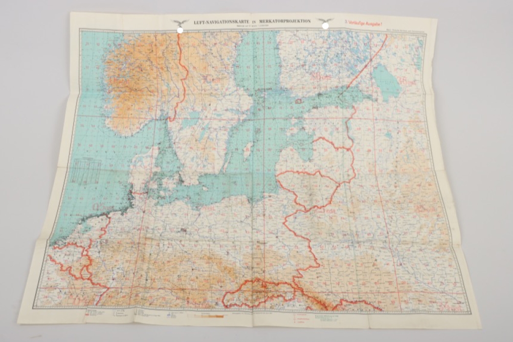
Map
Buy treasures for a reduced Buyer‘s Premium

1940 Luftwaffe navigation map "Östliche Nordsee & Ostseestaaten"
MILITARIA PRICE GUIDE
How can I see prices?
Welcome to the ratisbon's MILITARIA PRICE GUIDE!
To access all prices, pictures, and descriptions please subscribe to our MILITARIA PRICE GUIDE at www.ratisbons.com/militaria-price-guide. Save 25% when subscribing for one year! Get full access for just 75€!
We are buying single items and entire collections! Call +49 8541 9053699
-
PAYMENT
-
HOW CAN I PAY FOR MY ORDER?
AUCTIONSYou will receive an e-mail confirming your successful bids the day after the auction has ended. In your personal my ratisbon's you will be able to inform us about your most convenient payment method for this order or tell us about an alternative shipping address.
If we don’t hear from you within 24 hours, we will send an invoice choosing the payment and shipping options which we think are the most comfortable ones to you. If you decide to change your shipping or payment method after receiving your invoice, just drop us a line or visit my ratisbon's/ORDERS for any more details.
SHOP ORDERSChoose your payment method when ordering and submit your order. Once your order has been received we will send an invoice including your shipping costs and your payment instructions.
After receiving the invoice, the order must be paid within 7 days.
Please contact us to discuss layaway options.To learn more about paying at ratisbon's, please see your FAQ pages.
WE ACCEPT FOLLOWING PAYMENT METHODS
-
-
Versand
-
HOW DO YOU SHIP MY NEW TREASURES?
PACKING & TRACKINGWe usually send out orders within 1-3 working days after your payment has been received. In most cases, we are faster than this! We will inform you when your goods are being dispatched and provide a tracking number, In addition, you can always check your order status at my ratisbon's/ORDERS. Delivery times will vary depending upon the delivery destination and type of shipping service you have chosen.
SHIPPING TO ALTERNATIVE ADDRESSIf you prefer to have your order shipped to your work address or a friend during your absence, we will happy to arrange this for you. Send us an email letting us know about your new shipping address and we will be happy to send an updated invoice to you.
OUR LOGISTIC PARTNERS ARE AS FOLLOWS
-
-
OUR GUARANTEE
-
 OUR GUARANTEE!
We only offer collectables which to the best of our specialists knowledge are authentic. About 15% of all consignments are returned to the consignor after extensive research due to authenticity issues.
Unlike traditional auction houses we do offer a full right of return. If you are not satisfied with what you won or bought, you may return it within 14 days. Please inform us and we will instruct you on how to return the goods. For more information, please visit FAQ pages.
Important note: Cancelling bids after an auction may disappoint the consignor, who like you is a collector. This situation is easy to avoid. We encourage you not to bid on any collectable if you are unsure if it fits into your collection. Ask us to cancel your bid 24 hours prior to the end of an auction to avoid this situation.
-
COUNTRY Germany 1918 - 1945
DIMENSIONS
WEIGHT
EAN 4000000723563
PERIOD 1918 — 1945
COUNTRY Germany 1918 - 1945
COUNTRY Germany 1918 - 1945
LOT 65-1702
Map
Description
Luftwaffe navigation map "Eastern North Sea & Baltic Sea States". Made from paper. Issued in 1940. Size: 119x104 cm.
Condition
2

